Airborne Geophysical Surveys
EASY QUOTETerraquest has conducted over 2000 fixed wing, helicopter, and UAV airborne geophysical surveys in the exploration for base and precious metals, kimberlites, hydrocarbons, uranium, lithium, critical minerals, and groundwater. Our surveys also have been used for determining the regional geological features and structures. The company has flown in 30 countries on five continents so far.
The company currently operates five systems (three fixed wing platforms and two helicopter configurations) that are specifically equipped to meet a variety of airborne geophysical survey requirements. Also, Terraquest has access to 7 additional fixed wing aircrafts through its sister company to utilize as per the projects’ demands. Terraquest provides complete airborne geophysical survey services — from survey planning to data acquisition and data processing and final map preparation.
The company and its highly experienced staff have performed exemplary surveys for both small and large exploration groups as well as many government agencies. The company employs 18 professionals, including geophysicists, geologists, data processors, aircraft engineers and pilots.
Merging to AEROQUEST which is highly reputable geospatial company, now Terraquest is able to provide a full suite of Geonexus (Geophysical and Geospatial) solutions and map the features both on and under the ground with the highest possible quality and resolution.

GSA Today
Volume 31, Issue 11
© The Geological Society of America, Inc
A global operations footprint
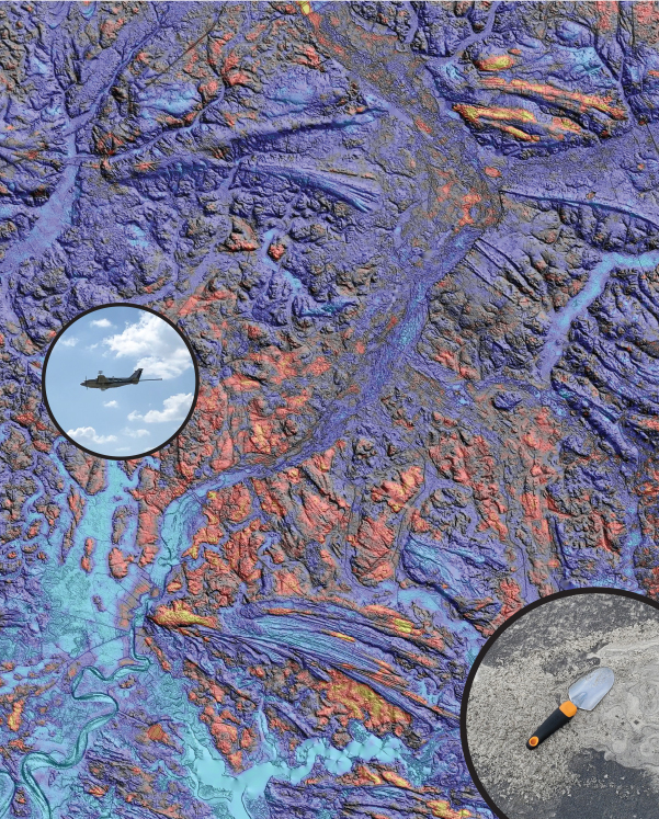
The map below shows a summary of these surveys on a variety of platforms and with a range of methods / capabilities. Terraquest can support multiple types of airborne geophysical surveys in many locations globally. If you require an airborne magnetic survey, airborne gravity survey, airborne radiometric survey, or airborne electromagnetic survey, Terraquest has the team, the platforms, and the technology to make your next survey project a success with Better Data, Better Results™.
Testimonials
The USGS Story – Four Surveys and over 100,000 Lkm of Better Data, Better Results
Terraquest was chosen as an airborne supplier of choice for the United States Geological Survey in 2016 and subsequently flew three airborne geophysical surveys, and has recently started a fourth project for the group (July 2020).
The initial airborne geophysical survey for the USGS was a 10,000 Lkm horizontal magnetic and spectrometer survey in South Carolina for research purposes to characterize particular types of mineralization. The detailed nature of the horizontal magnetic gradient products (including the Reconstructed Total Field) and gamma ray spectrometer elements were fundamental to the understanding and interpretation of this particular type of mineralization.
With this success, Terraquest was further contracted by the USGS for a 66,000 Lkm survey of Central Missouri to study the rock layers under a region of the southeast Missouri and eastern Illinois, providing state-of-the-art, subsurface maps that will contribute to a wide range of 3D representations of the nation’s exposed and concealed geology.
Subsequently, Terraquest completed a 33,000 Lkm survey with the same aircraft and with magnetic and radiometric systems to determine the geological framework surrounding known and potentially undiscovered critical mineral resources.
Thanks so much for your hard work on our survey so far. Your attention to detail, professionalism, and expertise is much appreciated. This will be one of the largest airborne campaigns the USGS has flown and the results will act as a showcase for our upcoming 3 DEEP Initiative.
– Anne McCafferty, USGS Project Manager
A Junior’s Story – Grassalco
Grassalco contracted Terraquest through a consultancy group to run an airborne geophysical survey in North America.
I am impressed that you were able to complete survey in spite of weather and airport issues so quickly. From a geologic standpoint, the data is great, and the client should be very pleased. It really does help the exploration.
– Dennis Lapointe, Consultant